I found Copenhagen's regional bike network to be one of the more fascinating aspects of the city. While practically every city street in Copenhagen is suitable for bikes, cycle superhighways are what take most people from the city to the outside.
When I first heard the word 'Cycle Superhighway' I was thinking of back at home in Portland, where the only real 'safe' regional bike networks are dedicated bike paths (the Springwater trail in Portland or the riverfront path in Eugene). This is because I had felt these are one of the only places where bikes can safely zoom along.
In fact, I had not realized that the road one block next to the hostel is one of the cycle superhighways (route C75). One reason I did not realize this was because (at least in the city) the superhighways look just like the other bike lanes in the city (however I later found out the cycle superhighways have a 'C' decal on the bike lane and a few other features that I will list later).
 |
| Cycle Superhighway with bike counter |
Right now, Copenhagen has a network of 16 of these Cycle Superhighways (with a goal of 60 by 2045). These superhighways follow 5 qualifying standards:
- Passable
- Accessible
- Comfortable
- Safe
- Secure
Almost all the bike lanes (cycle tract as they call it) in Denmark are elevated from the main road by a few inches. This is an interesting design choice as it means that the bike lanes here (in a sense) are very similar to the ones in the States, however, they feel much safer. Of course, drivers drive much slower here. Almost all drivers are also bike riders so they understand to look for bikes (getting 'doored' by a car is not a thing here). One thing that IS much different from the states is intersections. Most intersections have dedicated bike lanes/lights. On cycle superhighways, most intersections even have a bar to rest your hands/feet on when you come to a stop. Also, what I have heard (but have not been able to test) is that if you bike at 20 kph you will get every green light.
On one of our free days in Copenhagen, we were given a list of activities that we could do. One was to 'visit the end of a cycle superhighway.' After hearing someone else mention it earlier in the day, I got the great idea of riding a bike out to the 'end of the superhighway' and would then take the train back into the city. After mapping it out, it became clear that
route 77 to Ishøj would be a good route to do this. The train station is just a few blocks from the end of the superhighway, and the train back into town runs very frequently. Ironically, it was an overcast and rainy day, but I was also really feeling like going on a bike ride that day.
I first set off and made a quick detour at the
Bryggebroen and adjoining
Cykelslangen (very neat!). I then headed out to find the superhighway I needed. I quickly found it and started to make my way south.
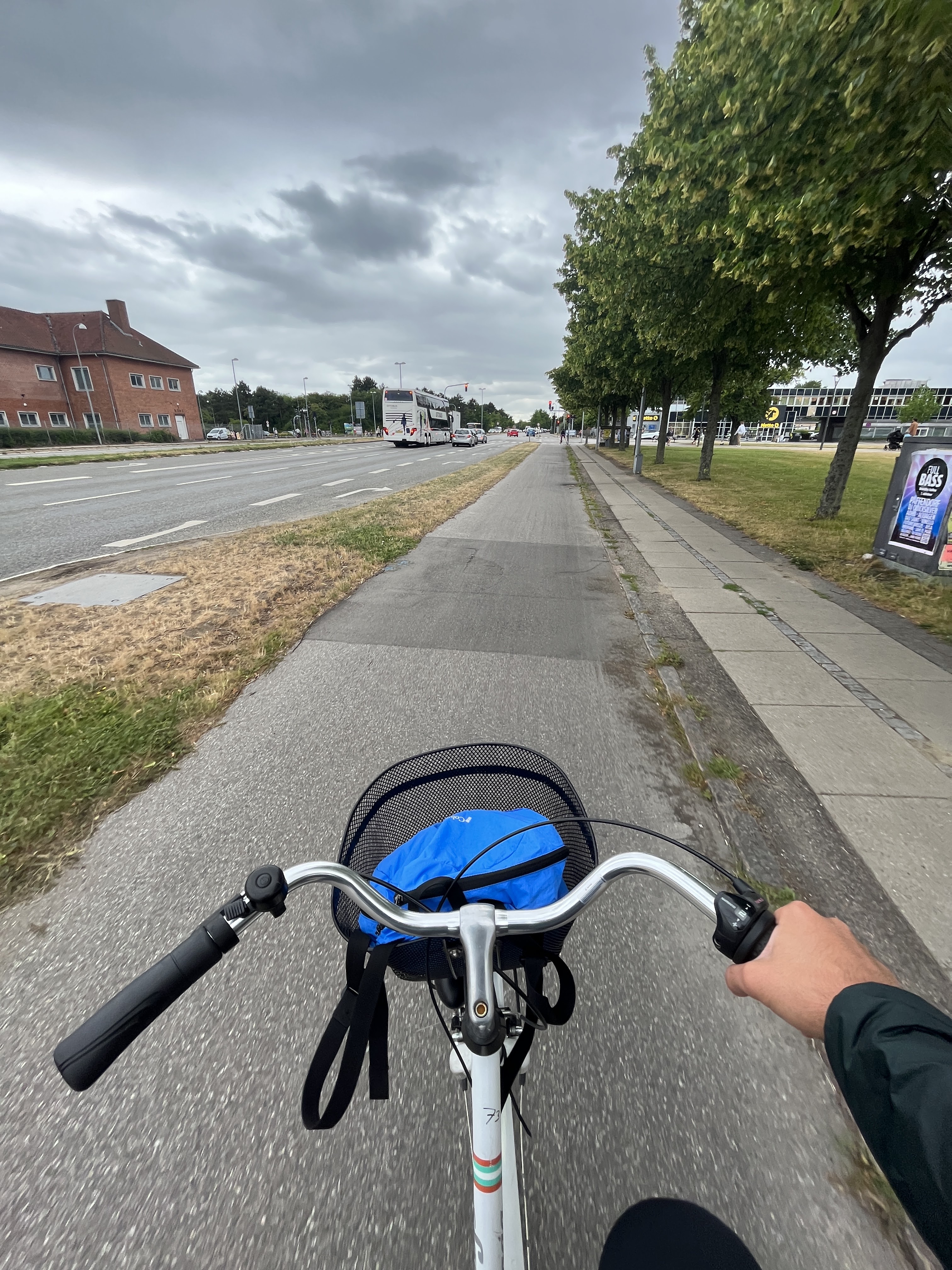
 |
| Cycle Superhighway POV |
The ride itself was pretty fun. As I got further away from the city center, the lights got spaced out more. The housing density slowly decreased. I knew I was getting far away when I started to see single-family homes. However, unlike in the states, the bike infrastructure didn't deteriorate as distance progressed. In fact, the road narrowed from 4 lanes to 2 lanes as Ishøj approached.
 |
| Mileage markers indicating how far away we are from certain destinations |
 |
| Turn left for Route 79, continue straight for Route 77 |
*The end of the line*
Battling the rain, as the end of the line approached, I wasn't sure what to expect. Will the bike lane end? Will there be a sign that says the superhighway has ended?
 |
| According to the map, this is where the cycle superhighway ends. |
I quickly found that while the bike lane continued down the road, it quickly turned into a shared bike/pedestrian walkway.
 |
Shared bike/ped walkway
|
Since Ishoj is just a suburb, it appears that appears you could keep on biking for a while more, even if it is not a superhighway. At least the train back into town for dinner was easy!
In closing, I was pretty impressed with the regional bike network offered in Denmark. In Oregon, aside from the dedicated bike paths, there are no real roads that have safe biking infrastructure. I would like to have a road with shared car/bike road (with safe separation, of course) implemented in the States.
If I were to do this again, I would try to do one of the longer superhighways that goes out into the countryside. Also, from looking at photos it seems like there are some superhighways that are dedicated bike paths, and it would be nice to see how those compare to the ones in the states and in Oregon (eg. are there many road crossings, do you constantly have to pass walking pedestrians, etc). I'll also be interested in seeing what similarities are offered in terms of a regional bike network by the Dutch when we visit there in a few days!


Comments
Post a Comment